Here are a few urls of short routes in the 10-25 mile range until I have time to make a complete post:
http://www.strava.com/routes/934325
http://www.strava.com/routes/934346
http://www.strava.com/routes/934359
http://www.strava.com/routes/934369
http://www.strava.com/routes/934386
Thursday, September 11, 2014
Friday, September 5, 2014
Medium Length Rides from Ithaca
 |
| Finger Lakes National Forest |
 |
| Howard Hill Road |
 |
| Greenwood State Park |
- To the west is a 55 mile route with 4500 ft. of climbing. Enjoy the views form the top of Picnic Hill rd and stop halfway down the descent of Taughannock Park rd to see the beautiful falls. This ride takes you past Treman State park and the Finger Lakes National Forest as well!
- Opposite Ithaca, this 38 mile route takes you over three quiet country climbs and through Dryden to the west. Enjoy the view of Dryden Lake and the finish along Fall Creek.
 |
| Taughannock Falls |
 |
| Cascadilla Street |
 |
| Route 90 |
 |
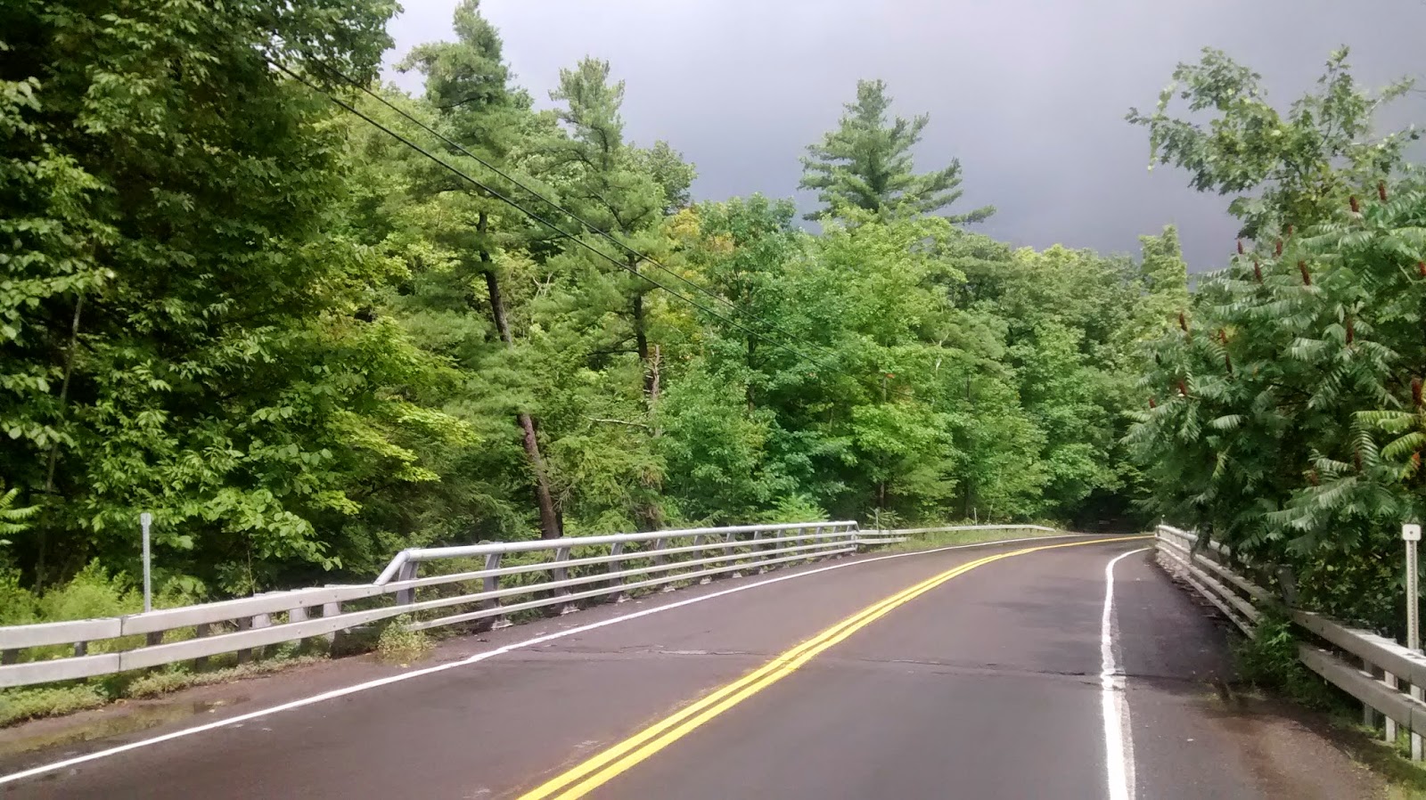
| View of Stewart Street Bridge from Fall Creek dr. |
- Our next route takes us southeast along a flatter 46 mile route - perfect for a paceline practice. Pound down Fairfield road, turn the corner and push it back up Back West Creek rd. The oft-ridden Old 76 provides a finishing climb to burn any extra energy.
- The southwest route is 45 miles full of challenging hills! Still a work in progress, this route includes some dirt/gravel sections. The descent down Route 327 provides flowing finish to this challenging ride with 4500 ft. of climbing.
- Finally, the northern ride offers another flattish 45 mile route. A classic Cornell cycling club ride, see how fast you can complete the Tempo Tuesday Strava segment. Travel a few extra feet down Mill st. in Ludlowville for a view of the picturesque falls on Salmon Creek.
Wednesday, August 27, 2014
Long Ithaca Routes
 |
| Fire Tower Road |
 |
| Comfort Road |
- Southeast to Greenwood County Park: 70 miles and 6400 ft. of climbing. Lovely country roads throughout with highlights on Howard Hill Road and Glen Road. Save some energy for the grind up Old 76. Stop for water at Greenwood park (and ice cream if you need same cold calories).
 |
| Old 76 |
- West to Whitney Point: 80 miles with 6200 ft. of climbing. Head up Old 76 and Glen road this time, continuing on a variety of exposed country roads to Whitney Point. Heading north past Whitney Point Reservoir on Route 26, a couple left turns take you up a steep dirt ramp on Gay Head Road. Fear not! The dirt ends as the road levels out and smooth asphalt leads the way home. Enjoy the climb up Owego Hill and the riverside ride on Lower Creek.
 |
| Old 76 |
- Owego Lake Loop: 85 miles and 4700 ft. of climbing. Highlights are the challenging climb out of Moravia on Long Hill Road and the subsequent lakeside riding. The ride down Salmon Creek Road is also a beautiful, quiet country road. Great loop for some fast rolling.
 |
| Yaple Road |
 |
| Unknown Field |
 |
| White Church Road |
- Cayuga Lake Lap: 90 flatter miles with 4200 ft. of climbing. Uses the obvious, main roads but gets some fantastic lakeside roads. Stop at Cayuga Lake State Park for water and some lakeside pictures. This route is pretty flat but save some energy for the exposed, hillier section near the end where water runs low and sweat rolls from the brow.
- Southwest Gil Route: borrowed from Gil Menda, a 78 mile with almost 7k ft. of climbing. South Danby Road, Wyncoop Creek and Hogback Road make a lovely route out. Shaffer road makes for a nice gradual descent back into Ithaca. Add Blakeslee if you have some extra energy at the end!
 |
| Chestnut Road |
Sunday, August 17, 2014
Steep Ithacan Hills
There are a number of beautiful, precipitous country climbs in the Ithaca area. Some of the steepest are described below. Incorporating these hills into a ride will be sure to raise your heart rate and drop your average speed.
- Starting right in downtown Ithaca, two climbs ascend towards higher knowledge on the hill to Cornell. Kline road and Cascadilla Park Road offer some quick access climbing. Kline starts out steep and stays that way for a quarter mile at 16%. Rough pavement and a narrow road mean caution is in order. Cascadilla offers a more tame half mile at 8%. The road's three switchbacks and dense housing confer a European charm. Try and best Dan Timmerman's time if you're feeling strong.
- Moving to the opposite side of town, Bostwick and Culver Roads take you on a longer climb up the western hill. Both hills average 8.5% on roads that end in country greenery. 1.7 and 1.4 miles respectively, these are challenging climbs with gradients that waver slightly throughout. Great climbs through which to leave the Ithaca area.
- A few miles to the south we find 5.6 miles of Shaffer Road at 4.3%. One of the few Cat 2 climbs in Ithaca, after climbing a steep opening ramp the climb gradually rolls upwards with a couple sharp inclines. This is a quiet road with nice views down into the valley on the left.
- Autumn Ridge Lane is the steepest short climb in the Ithaca area. Beginning at a pedestrian 8% or so, soon it kicks up to a grade barely passable with actually walking. The top ramps up to around 20% for very painful quarter mile of road. Out-and-back, this road receives very little traffic - by car or bike.
- Just down Coddington Road comes another challenging climb - East Miller. Fairly straightforwards, just a steep, pretty steady mile long climb at 10%. Great for breaking speed records on the way down but careful of the steep end at a stop sign.
Some more hills:
- Blakeslee Hill Road - 1.5 miles of 10%
- Protts Hill - Half mile of 12%
- Sovocool Hill Road - mile of 10%
- Legge Hill - another mile of 10%
 |
| One that didn't make the final cut - Blackman Hill Rd |
 |
| Protts Hill |
 |
| Autumn Ridge Lane |
 |
| Autumn Ridge |
 |
| Legge Hill |
 |
| Blakeslee Hill Road |
Thursday, July 31, 2014
Northern Colorado Rockies
 |
| My bike at Brainard Lake |
The Rocky Mountains in northern Colorado provide a number of challenging ascents in close proximity to a public willing to take advantage of them. Near Boulder, roads like Flagstaff, Sunshine Canyon and Lefthand Canyon provide quick access to the mountains. Further north, Trail Ridge Pass is the highest paved continuou road in the U.S. To the south, Mt. Evans, Loveland Pass, Vail Pass and others provide as much climbing as your legs can hold.
 |
| Boulder Canyon |
To plan a route, look at the Strava Global Heatmap to find popular routes. The best climbs have already been listed above:
 |
| Daniel Stauffer in Boulder Canyon |
 |
| Four Mile Canyon |
 |
| Lee Hill Drive |
- Flagstaff road: Steep 4.5 mile climb at 8%. Ramps near the top will halve your cadence. Awesome return descent on the switchbacks.
- Sunshine Canyon: Nearly 6 miles at 6%, the average grade disguises a number of steep ramps around 10%. The descent easily allows for speeds up to 50 mph.
- Lefthand Canyon: a much gentler climb at 4%, it climbs up to the P2P Highway for 18 miles. Many dirt sections from flooding in 2013.
- Trail Ridge Road: 10.5 miles at 5%, enjoy amazing views from the top! $10 entry fee for bikes (part of Rocky Mountain National Park). Elevation extends over 12k ft, bring an oxygen tank or two if you aren't worried about Watts/kg.
- Loveland Pass: Another high pass, this time with ski resorts. Beautiful two-lane bike path leads to start at Loveland Ski area. Climb can be started as far down the canyon as you please. Both sides of the pass are amazing rides.
 |
| Top of Lee Hill Drive |
 |
| Route 34 leading to Trail Ridge Road |
 |
| Devil's Gulch Road |
 |
| Devil's Gulch |
 |
| Trail Ridge Pass |
 |
| Loveland Pass bike trail |
My rides in the area:
Day 1: Lovely loop into the mountains with a nice detour to see Brainard Lake.
Day 2: Trip up Sunshine Canyon.
Day 3: Flagstaff and Four Mile Canyon. Rest of the loop was uninspiring.
Day 4a: Flagstaff and Sunshine again. The nicest climbs (and descents) in Boulder.
Day 4b: Lovely short loop on Olde Stage, Lee Hill and Lefthand Canyon.
Day 5: Eldarado Canyon. Rough road, would be awesome on a CX bike.
Day 6: Long day, lots of climbing up Trail Ridge. Gulch Rd/County Rd 43 is a must do if you don't mind some dirt: almost zero traffic and great riverside scenery. Beware! No water above park entrance. Bring at least 3 bottles if climbing to the top.
Day 7: Gorgeous! Awesome bike path to get up to start. Do both sides and takes lots of pictures.
 |
| Loveland Pass |
 |
| Loveland Pass |
 |
| Arapahoe Basin |
Friday, July 18, 2014
Bighorn Mountains, WY
 |
| Rt. 14 to the west |
Route 14 from West: Starting steeply in a scenic canyon, you gradually climb out onto the open hills at higher elevation. A bathroom/parking lot 10 miles in also has a drinking fountain. The top of the climb is somewhat shallower but grades are fairly consistent throughout. Quite a slog at 18 miles in length. As you leave the canyon the surrounding mountains tower above, providing the best views.
 |
| Climbing Granite Pass out of the canyon (Rt. 14) |
Route 14A: The toughest climb I've ever done. A 3.5 mile section at 10% in the middle makes lower gearing a near necessity. Unfortunately, I did not have such a luxury and my knees paid the price. As did my bike - the rear wheel's hub axle sheared apart near the top and required an early descent and new rear wheel. Approach this climb with a lightness of body, not mentality. The descent is also challenging and I stopped frequently to cool my brakes. The best climb in the Bighorns, the curves and views take 14A to the next level of ascending. But bring low gears!
Route 16 from West: Another long, gradual climb. Starting out in a large valley, there are only a couple switchbacks before the ascent straightens out. Water can be found in campgrounds along the way but not directly by the road. Rollers near the top mean the average gradient betrays the steepness of some sections. Not a particularly difficult climb but takes time. I didn't do this ride (broken bike) but my brother did and reported back.
 |
| Rt. 16: Powder River Pass |
 |
| Granite Pass |
 |
| Trail to Mistymoon Lake |
 |
| Rt. 14 from the East |
 |
| Rt. 14A: the mountains that lay ahead |
 |
| Switchbacks on Rt. 14A |
 |
| Camping by Mistymoon Lake |
 |
| View from Cloud Peak |
Bighorns Day 1: Granite Pass (Rt. 14) from both sides. Stopped early from the East because of a hornet in my jersey whose stings made breathing difficult.
Bighorns Day 2a: Rt. 14A - hard climb but you just keep pushing. Careful on the descent!
Bighorns Day 2b: Hike in to Mistymoon Lake - nice 6 mile hike. Bring bug repellent in summer: clouds of mosquitoes.
Bighorns Day 3: Climbing Cloud Peak from Mistymoon Lake and hike back out. Lots of climbing large boulders, no discernible trail most of the time.
Bighorns Day 3 Daniel: Powder River Pass from West. Scenic start, steepest through the middle. Rolling at top.
 |
| Author atop Cloud Peak |
Saturday, July 5, 2014
Minneapolis, MN
 |
| Minnehaha Falls |
 |
| Typical bicycle path |
Serious cycling in Minneapolis is, in a word, frustrating. A great system of trails connects much of the city but doing a long ride into the country is not so simple. Harsh winters result in poor road quality, most roads outside the city are busy and not bicycle friendly and there is a dearth of hills. As a result, this review will cover roller skiing in the Minneapolis area. These routes will also cover casual cycling interests.
The best route takes you on a tour of four lakes to the southwest. The entire route runs along bike trails (though some sections get flooded in a summer as rainy as this). Flat, of course. Look for water fountains all along the way and stop at Minnehaha falls (first image).
 |
| Hilly Afton |
 |
| Afton country road |
Theodore Wirth park also has some smooth trails in a somewhat less urban environment. Just expect an out-and-back.
The nicest route I found was 20 minutes away in Afton. Covering a number of country roads and actually including hills, it makes for an extended workout. Make sure to go early on hot days; the oil-gravel road surface softens in summer heat and it feels like roller skiing through plato. The road also grabs yours wheels and pulls you to a stop - high crash danger. The Afton area kills Minneapolis in terms of roller skiing and biking.
 |
| An Afton house ensconced in nature |
Tour of Lakes - Roller ski marathon. Nice views and asphalt.
Along the Mississippi - Nice paths along Mississippi. Instead of dropping down to river, stay along Hiawatha Ave. for smoother trails and to avoid a "challenging" descent.
Theodore Wirth Park - Very lovely trails in the park but somewhat short and only out-and-back.
To Roseville - The University Transitway is well-paved with little traffic. The way out is bad but the return trip was nice bike paths. Continue just a bit further to go around some lakes.
Afton Roller Ski - Lovely, quiet country roads. Avoid skiing here during summer midday - road surface softens and makes roller skiing impossible.
 |
| Bike path in Theodore Wirth Park |
Apple Valley - 80 miles, nice finish along the Mississippi near St. Paul.
Northwest - 112 miles. Beware prevalent southern winds will give strong headwind on return. Avoid E. Viking Blvd. which is block by Polaris compound.
Orchard/Crystal Lake - 70 miles. Nice lake views, variety of quiet residential roads.
Minnetonka Lake - 66 miles - dirt paths both ways. Carver Park is highlight with some very isolated bike trails. Shoreline Dr. along Minnetonka is also nice but very trafficked.
Subscribe to:
Posts (Atom)