Saturday, December 3, 2016

Mt. Rainier

Mt. Rainier
More often the destination of alpine climbers than the cycling grimpeur, Mt. Rainier offers multiple ways to collect big elevation numbers. With roadways restricted by the Cascade Range, cycling in area entails big loops, lengthy climbs, and sweeping vistas. While in the area, consider hiking at least part of the Wonderland Trail and camping in one of the many campgrounds in the National Park.

While there are several great rides here, first a note of warning: the riding is almost universally narrow two-lane roads without any shoulder. Try to avoid high-traffic times (summer weekends) lest a line of angry motorists gather behind you.

Chinook Pass
RAMROD Loop: A massive loop around Mt. Rainier, this ride takes place yearly. Covering two mountain passes and 150 miles, this ride requires a high level of fitness. From Paradise enjoy the views back down into Longmire and out over the descent to come. Next, descend (with a small ascent) down to the WA-123 and climb back up to Cayuse Pass. No views here, sorry. A long descent becomes more gradual as you go until the grade is imperceptible. From Enumclaw, a series of rolling roads bring you back to the start in Elbe.

I have not personally ridden, or driven, many of these roads so I cannot speak to road quality or traffic volume. However, keep in mind the narrow road warning. Drivers on 410 do not expect cyclists and I would prefer to do this loop with the safety of numbers in the annual RAMROD ride.

Cayuse Pass
Sunrise Climb and Chinook Pass: Two passes easily accessed from the White River Campground. Climbing Cayuse Pass and turn left to follow the climb up to Chinook Pass with an incredible view down the Mather Memorial Highway. The climb to Sunrise also results in fantastic views of the ridges surrounding Mt. Rainier as well as the mountain itself on clear days. Sunrise is a gradual climb at 4.5% for 10 miles and while Chinook Pass is a similar grade for 8.3 miles.

Mt. Rainier from Stevens Canyon Rd.
A Ride to Paradise:

Mt. Rainier

Sunrise

Thursday, December 1, 2016

The Oregon Coastal Mountains

Bear Camp Road


Searching for quiet, beautiful backroads with amazing views, moderate temperatures, and good roads? Look no further than the Oregon Coastal Mountains! Want a side of blackberries and clouds of mosquitoes on the side? Once again, you're in luck!

These roads are some of the least-traveled I've ever found. Save for a few logging trucks rumbling around the hillsides, you can go a whole ride without seeing more than a dozen cars. Advance ride planning is very difficult unless you're willing to travel on many rough gravel roads. While there are great paved routes, every road is so small pavement can be hard to distinguish on satellite images. Fortunately, along with the routes I provide, this blog has a few routes in the area and many more in the greater Oregon/California region. Read on for insight on lodging, climbing, and eating blackberries.
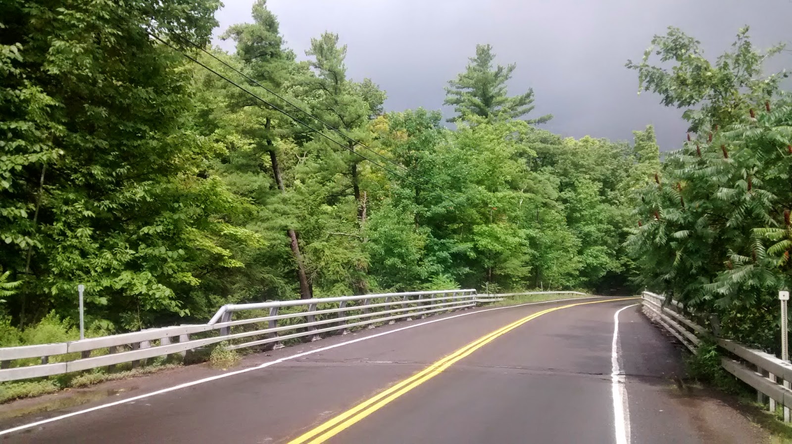
Bear Camp Road 
Climbing: Bear Camp Road receives universally glowing reviews from my polling group (n=3). Whether you want a huge climb (over 4500 ft), wildlife (I saw 2 black bears and 2 falcons), or amazing views, this road has it all. The west side is a fairly continuous climb of 5.3% for 16 miles. The east starts with a challenging section of 6.8 miles at 7% before mellowing for the last 1500ft of climbing. With little shade, try to avoid the steep east side on a hot, sunny day. Doing both sides of the climb in a single day is a massively difficult but enjoyable undertaking. Make sure you have plenty of food and water as none is available anywhere on Bear Camp Road and requires a detour on both ends.

If I only had time for one side, the west has a better climb for pacing, better views, and more shade. But this road is worth taking some time for.
Bear Camp Road


Tour de Fronds
 Lodging and Eating: If visiting in mid-July, stay at the Foster Bar Campground. With plentiful wild blackberries and few fellow campers, this is a place you could spend some time. Stock up on berries every morning, every trip to the bathrooms, every dinner, whenever you're hungry, when you're not hungry but see a nice berry... Delicious, ripe, and one of the highlights of our time in the region. There is also the Cougar Lane Lodge a bit south on Agness Road.

On the eastern side of Bear Camp Road, the Galice Resort has water and ice cream. Stock up on calories if heading back over Bear Camp, you'll need some energy to repeat that climb.

In general, small campgrounds litter the area and all supply water and a place to set up camp.

Ghost Town: From Galice, head north on Galice road and continue onto Lower Graves. Follow the route to the ghost town of Golden. While I haven't had the chance to ride this route myself, the bestrides site regards it highly.
Tour de Fronds
Isolation: The Tour de Fronds is a route I borrowed from Jay Rawlins and it is a beauty! There are a variety of rides in the area all under the Tour de Fronds umbrella but many include gravel. Surprisingly, this route is entirely paved, though road quality varies. Bring water, food, and a flat repair kit - there are no nearby services. Besides a few clear cut slopes, the area is full of dense forest and mossy roads. Make sure you have a good map of the area or a route on your GPS before heading out, this is not a good place to get lost. Warnings aside, these roads are the most isolated riding I've ever found. Forget about staying to the right, the whole road is yours. In areas, ferns cover the ground and a clear river flows alongside the road.

If you miss your qualification for the big race in France, it's Oregon namesake is a ride that will provide ample time for reflection and meditation. Just ride faster than the mosquitoes!

Tour de Fronds

Cougar Reservoir on the Aufderheide Highway
Descending: McKenzie Pass is one of the better descents I've ridden. With a number of switchbacks and swooping curves, it presents a technical challenge.  Add in the lower section where I neared 50 mph and this descent has a little of everything.  Starting at the bottom (on either side: Route 126 or Sisters, OR), enjoy a long climb for around 20 miles. At the top, take in the view atop the strange black tower built of the local Igneous rocks. Peering out across the lava fields, many mountains are visible including the Three Sisters, Mt. Jefferson, and Mt. Washington. Then, head west down the descent to Route 126 and after a few miles of slowly rolling descent, the real fun begins!

Note: This road is about 100 miles north of the rest of these rides and while the roads are still beautiful, expect a lot more traffic.
Switchback on McKenzie Pass

McKenzie Pass Summit

Thursday, November 5, 2015

Smoky Mountains

It's been a while since I posted, I guess I was waiting for something worth writing about. Well let me tell you, the Smoky Mountains in mid-autumn are worth covering! Gorgeous leaves, long climbs, quiet roads (and some really busy ones), and all-around amazing riding. I'll take you through a short tour of some of the biggest climbs in the area and recommend some routes. It should be pointed out that drivers in the South are quite friendly to cyclists and usually wait until a safe passing opportunity arises. Try to return the favor by pulling over in cutouts if a long line of traffic forms behind you.

Between cloud layers on the Cherohala Skyway
Let's start with a brief characterization of roads in the area. A main conduit for cycling is the Blue Ridge Parkway which ends it 469 mile trip south just outside of the Smokies. This road is full of long, gradual (no steeper than 5%) grades and descents with short tunnels and gentle turns. The views can be gorgeous and the asphalt is generally fresh but there are rarely challenging climbs or tricky turns. Too much distance on the Parkway can become monotonous. Several of the roads discussed below have similar topology. We'll go south to north in our routes.

The view from the top of River Road

Bald River Fall
  • Cherohala Skyway - Constructed recently in 1996, this 43 mile mountain road connects the towns of Tellico Plains, TN and Robbinsville, NC. This road climbs gradually out of Tellico Plains with some steeper ramps and several short downhill sections. With the descents, it takes a full 30 miles to reach the summit or 23 to reach the state line (a popular turn-around point). The side from Robbinsville is a challenging 10.5 mile climb mostly at 7% with some flatter sections for a 5% average. Water can be found at Rattler Ford Campground on the east and the Tellico Plains visitor center on the west. The Skyway is as quiet a major climb as I have found, especially in the early morning. I went 30 minutes without seeing another person at one point. Extended views are a bit rare but nice when they come. This road is worth doing if only for the isolation. Very similar in nature to the BRP.
  • The lovely River Road leaves the Skyway 5 miles in from Tellico Plains and makes a more gradual, consistent climb for 20 miles at 2% to the state line. Near the end, the road kicks up through some photogenic switchbacks to end in a single lane, gravel road. Early into the climb, you pass Bald River Falls and continue to follow the river for nearly the entire climb. An easier alternative to the Cherohala Skyway, River Road has more scenery with the falls, river, and views from the top with similar traffic. River Road earns the stamp of quality road from cyclingdr.
Cades Cove Loop
  • Cades Cove is probably the busiest 11 mile loop you'll ever see. Filled with traffic moving only in stops and starts, expect to take over an hour to cover it if you arrive during normal hours. Try to ride it on a Wednesday or Saturday morning in the summer when the loop is closed to motor traffic. Mountains loom on all sides and black bears sometimes relax in the meadows. Take a twisty, challenging climb up Rich Mountain Road if you have your cyclocross bike, it's a road you won't regret climbing!
A break in the trees on Rich Mountain Road

Rich Mountain Road

Early morning light on Route 441
  • Clingman's Dome is a very trafficked road. Starting from either side on Route 441, go early and get off the climb ASAP. Traffic begins to back up, even on weekdays. A few tunnels and a unique 270° turn are some of the highlights, along with amazing views and a fun set of turns near the top of the descent on the western side. The last 1/2 mile of the climb must be walked unless you do the climb after it closes in December. The top does offer nice views from a large spiral viewing platform but is probably not worth the clumsy hike up in cycling shoes. The western side is a nicer climb in terms of road interest (turns, gradient) but the views near the top of the eastern side are incredible. Ideally, climb the western side but detour over to the outlooks on the east on your way down. Water is available at the visitor centers on both ends of Route 441 or for sale at the top of Clingman's Dome. Definitely a climb to do if you can find a quieter window in the traffic.
Sunrise on Route 441

View near the top of Route 441

Top of Clingman's Dome!
There are several other roads in the area to consider riding:
  • Foothills Parkway - Another BRP-like road, this medium traffic road takes you along a ridge with great views into the Smoky Mountains. Scenic, challenging climbs on the east and the west
  • Blue Ridge Parkway - Ending at Route 441, the Parkway will take you as far north as a ride can go. Try the challenging climbs up Waterrock Knob, quiet Route 215, or the Pisgah Highway. Watch out for tunnels that appear short but actually have no light in the middle. Nearly every climb up to the Parkway is more interesting than the BRP itself, so don't restrict yourself to the main road!
  • Tail of the Dragon on Route 129 - If you want to run with the bulls, take Route 129 along the Little Tennessee River. Known for it's density of winding turns and challenging driving, sports cars and sport bikes flock to the area so expect a lot of dangerous, crowded roads. I haven't ridden it myself, nor can I really recommend it.
  • Laurel Creek/Little River Gorge Road - Connecting Cades Cove and the road up Clingman's Dome, these roads twist along creeks, through tunnels, and along some gradual climbs. Traffic can be high, so take care. Still very scenic and fun to drive as well (though Rich Mountain Road takes the rally track crown).
270° turn on 441
Finally, if you have a cyclocross/mountain bike - congratulations! You have access to much more of the area and surely some incredible backroads. Send us road riders some pictures when you get back. Overall, the area has some incredible scenery but traffic can be frustrating if you don't leave early and plan accordingly. Going in fall is sure to provide some breathtaking moments, like when a RV passes a bit too close. Enjoy the monster climb on Clingman's Dome and try sleeping in one of the numerous local campgrounds. Don't forget, these days the smokiness comes from air pollution so make sure you stay on your bike and keep the car in the garage.

Looking down onto the coming 441 east descent

Route 441 through fall leaves

Entering Pisgah forest on Lake Logan Road

Thursday, September 11, 2014

Short Ithaca Rides

Here are a few urls of short routes in the 10-25 mile range until I have time to make a complete post:
http://www.strava.com/routes/934325
http://www.strava.com/routes/934346
http://www.strava.com/routes/934359
http://www.strava.com/routes/934369
http://www.strava.com/routes/934386

Friday, September 5, 2014

Medium Length Rides from Ithaca

Finger Lakes National Forest
Howard Hill Road

Greenwood State Park
 A route in the 40-50 mile range for each direction from Ithaca:

  • To the west is a 55 mile route with 4500 ft. of climbing. Enjoy the views form the top of Picnic Hill rd and stop halfway down the descent of Taughannock Park rd to see the beautiful falls. This ride takes you past Treman State park and the Finger Lakes National Forest as well!
  • Opposite Ithaca, this 38 mile route takes you over three quiet country climbs and through Dryden to the west. Enjoy the view of Dryden Lake and the finish along Fall Creek.


Taughannock Falls

Cascadilla Street

Route 90
View of Stewart Street Bridge from Fall Creek dr.

  •  Our next route takes us southeast along a flatter 46 mile route - perfect for a paceline practice. Pound down Fairfield road, turn the corner and push it back up Back West Creek rd. The oft-ridden Old 76 provides a finishing climb to burn any extra energy.
  • The southwest route is 45 miles full of challenging hills! Still a work in progress, this route includes some dirt/gravel sections. The descent down Route 327 provides flowing finish to this challenging ride with 4500 ft. of climbing.
  • Finally, the northern ride offers another flattish 45 mile route. A classic Cornell cycling club ride,  see how fast you can complete the Tempo Tuesday Strava segment. Travel a few extra feet down Mill st. in Ludlowville for a view of the picturesque falls on Salmon Creek.

Wednesday, August 27, 2014

Long Ithaca Routes

Fire Tower Road

Comfort Road
 Here is a list of nice routes over 70 miles in the Ithaca area. They are all on paved roads unless otherwise noted.

  • Southeast to Greenwood County Park: 70 miles and 6400 ft. of climbing. Lovely country roads throughout with highlights on Howard Hill Road and Glen Road. Save some energy for the grind up Old 76. Stop for water at Greenwood park (and ice cream if you need same cold calories).


Old 76

  •  West to Whitney Point: 80 miles with 6200 ft. of climbing. Head up Old 76 and Glen road this time, continuing on a variety of exposed country roads to Whitney Point. Heading north past Whitney Point Reservoir on Route 26, a couple left turns take you up a steep dirt ramp on Gay Head Road. Fear not! The dirt ends as the road levels out and smooth asphalt leads the way home. Enjoy the climb up Owego Hill and the riverside ride on Lower Creek.

Old 76

  • Owego Lake Loop: 85 miles and 4700 ft. of climbing. Highlights are the challenging climb out of Moravia on Long Hill Road and the subsequent lakeside riding. The ride down Salmon Creek Road is also a beautiful, quiet country road. Great loop for some fast rolling.

Yaple Road

Unknown Field

White Church Road

  • Cayuga Lake Lap: 90 flatter miles with 4200 ft. of climbing. Uses the obvious, main roads but gets some fantastic lakeside roads. Stop at Cayuga Lake State Park for water and some lakeside pictures. This route is pretty flat but save some energy for the exposed, hillier section near the end where water runs low and sweat rolls from the brow.
  • Southwest Gil Route: borrowed from Gil Menda, a 78 mile with almost 7k ft. of climbing. South Danby Road, Wyncoop Creek and Hogback Road make a lovely route out. Shaffer road makes for a nice gradual descent back into Ithaca. Add Blakeslee if you have some extra energy at the end! 
Chestnut Road 

Sunday, August 17, 2014

Steep Ithacan Hills

There are a number of beautiful, precipitous country climbs in the Ithaca area. Some of the steepest are described below. Incorporating these hills into a ride will be sure to raise your heart rate and drop your average speed.

  1. Starting right in downtown Ithaca, two climbs ascend towards higher knowledge on the hill to Cornell. Kline road and Cascadilla Park Road offer some quick access climbing. Kline starts out steep and stays that way for a quarter mile at 16%. Rough pavement and a narrow road mean caution is in order. Cascadilla offers a more tame half mile at 8%. The road's three switchbacks and dense housing confer a European charm. Try and best Dan Timmerman's time if you're feeling strong.
  2. Moving to the opposite side of town, Bostwick and Culver Roads take you on a longer climb up the western hill. Both hills average 8.5% on roads that end in country greenery. 1.7 and 1.4 miles respectively, these are challenging climbs with gradients that waver slightly throughout. Great climbs through which to leave the Ithaca area.
  3. A few miles to the south we find 5.6 miles of Shaffer Road at 4.3%. One of the few Cat 2 climbs in Ithaca, after climbing a steep opening ramp the climb gradually rolls upwards with a couple sharp inclines. This is a quiet road with nice views down into the valley on the left. 
  4. Autumn Ridge Lane is the steepest short climb in the Ithaca area. Beginning at a pedestrian 8% or so, soon it kicks up to a grade barely passable with actually walking. The top ramps up to around 20% for very painful quarter mile of road. Out-and-back, this road receives very little traffic - by car or bike.
  5. Just down Coddington Road comes another challenging climb - East Miller. Fairly straightforwards, just a steep, pretty steady mile long climb at 10%. Great for breaking speed records on the way down but careful of the steep end at a stop sign.
Some more hills:
  1. Blakeslee Hill Road - 1.5 miles of 10%
  2. Protts Hill - Half mile of 12%
  3. Sovocool Hill Road - mile of 10%
  4. Legge Hill - another mile of 10%

One that didn't make the final cut - Blackman Hill Rd
Protts Hill

Autumn Ridge Lane

Autumn Ridge

Legge Hill
Blakeslee Hill Road