Saturday, June 21, 2014

Glacier National Park!


Avalanche Lake
    Glacier NP contains some of the finest scenery in the US. Located in a northern Monata, the park still gets 1.6 million visitors per year - a testament to its beauty. Only one road, Going-to-the-Sun road, penetrates the interior of the park (and extends the entire way through). On this road you can climb 3500 ft. up to Logan Pass at 6646 ft. elevation. Usually at least one section of the road is under construction so expect delays.

    Be careful of the red touring cars full of visitors - they have knocked a few people off their bikes and drivers behave in a cavalier fashion. Don't be afraid to take the lane if passing isn't safe; traffic can come to standstill anyways because of heavy congestion. Due to this gridlock, cyclists are required to have ascended to the pass by noon. The earlier your start the better: less traffic means more time spent looking out into the valley. Most cyclists climb from the West - if you have the energy descend the other side and climb back up. The east side is a shorter climb (10 vs 7.5 miles, both at 5%). Dropping back back down to Lake McDonald (the west side) in the afternoon can be frustrating; traffic tends to travel more slowly than a fast cyclist descends. I probably passed around 20 cars on the way down but a slightly more cautious approach is recommended (I had a scary moment slipping between two cars).
Avalanche Creek running through a gorge
     Glacier Park requires an 7-day entry permit that costs $25 per car, $12 if on bike. Going-to-the-Sun road only opens in mid summer: see this link for an idea of how much snow needs plowing. Sections of the road also close mid September so plan your trip accordingly if you want to ride this fabulous climb. You can get more water at the visitor center atop Logan Pass.

    I suggest starting from the southwest end of Lake McDonald and enjoying the flat 10 mile stretch along the lake. Follow the road as it begins to slowly climb along McDonald Creek. As you part ways with the creek (mile 20), the climb begins immediately and climbs steadily at 5% to the top for 10 miles. Continuing down the other side is just as nice a road if you have the energy. The return descent can be skipped if you're soaked in freezing rain, as I was, by taking a free shuttle back down. I was even allowed to put take my bike inside the uncrowded shuttle bus. There aren't too many miles of riding but the hiking is also amazing.

    I don't suggest going to Glacier without a bike, this is a can't-miss road. Here are gps files of my two days in the park:
Day One a: Logan Pass Ascent from West in cold, cold rain
Day One b: small side road from the park station
Day Two: Logan Pass from West, then East and return descent - best day of biking of my life

Clements Mt. to the left and Logan Pass center from east Going-to-the-Sun rd.

Going-to-the-Sun Road
View of Mt. Cannon and Clements Mt. from Going-to-the-Sun Rd.

Sunday, June 15, 2014

Bozeman, Montana

Bridger Mountains
     Surrounded by mountains in the Gallatin Valley, Bozeman offers a number of long, gradual climbs for cyclists. There are a few scenic, low-traffic routes from the city. Outside of these routes though, a cyclocross or mountain bike would make for much more cycling variety.
    The ride through Bridger Canyon is a 20 mile gradual ascent at average 2% grade. Pavement is decent, traffic is reasonable and the views are breathtaking! As is the altitude if you're new to town. Two roads branch off of Bridger Canyon rd. that are worth taking: Kelly Canyon is a steep little detour to town and Jackson Creek takes you over to the I-90 frontage road. Avoid Brackett Creek rd. unless you want to ride 15 miles of large, loose gravel and dirt that works its way into every part of your bicycle. The I-90 frontage road is quite empty and not dangerous to bike towards Livingston. On the other side of Bozeman (towards Belgrade), the frontage road is busy and shoulderless - I don't advise cycling there.
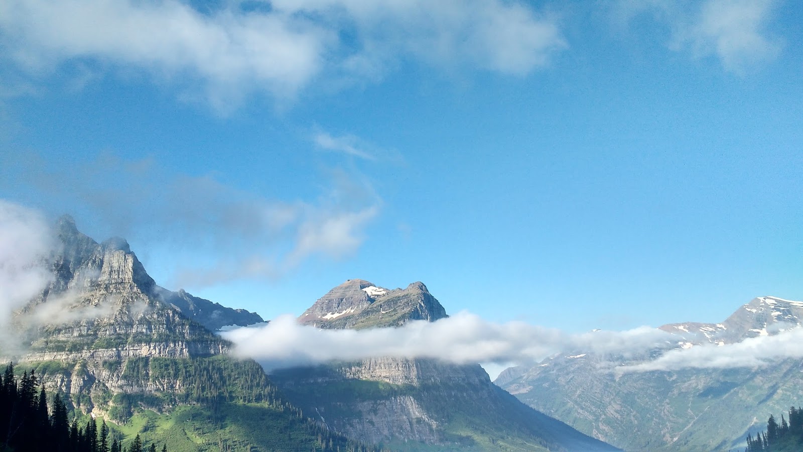
Elephant Mountain past Hyalite Reservoir
     Another great ride goes up to the Hyalite Dam in the Gallatin Range. The climb itself is 10 miles at 3%. The climb steepens towards the top but the creek and mountain views inspire upward progress. A dead-end road, traffic is usually not hurried and drivers are careful. At the top, the pavement continues into a dirt track that would make for good cyclocross riding. The view of the lake and mountains at the top is wonderful. The return descent shoots you back out to the Gallatin Valley.

Sunset over Bozeman
Mountains from Bridger Canyon Rd.
    The riding in Bozeman itself is uninspiring, though there are plenty of quiet roads to get out of town and the Triple Tree Development has a nice little section with fresh pavement. Riding to the west leads to fairly flat riding with a few nice roads along creeks.
    My favorite ride during my summer in Bozeman was a century ride over to Paradise Valley. Passing through Kelly Canyon and Jackson Creek, it covers the nicest roads to the east. Taking the frontage road down to Livingston, you then head south on East River rd. An alternative to the highway, this road has very little traffic and pleasant views of the Valley. The crowning jewel of this ride is a Luccock Park rd, a climb that leads you onto the lower mountain slopes to a church camp. Climbing up gives a nice perspective out into the valley below. The return trip follows the same roads; save some energy for the 25 mile slog out of Livingston up the frontage road!
Bridger Mountains from the west
Top of Luccock Park climb in Paradise Valley 
Joshua Mirth with Big Sky Ski Resort in background
The road riding in Bozeman provides a few great mountain views and challenging climbs but once you ride these, there is not enough asphalt for much variety on longer rides. A cyclocross or mountain bike would open up a vast network of fire roads that would make amazing riding. The consistent highlight of Bozeman riding is Hyalite itself.

GPS routes:
Hyalite Canyon - 40 mile route up to lake in the mountains
Bridger Canyon - 50 mile out-and-back between two mountain ranges with great views
Western Loop - 65 flat miles of sun exposure. Best riding to the west I could find
Kelly Canyon/Jackson Creek - Nicest climbs near Bozeman on smaller country roads. Can easily be shortened
Eastern Century - Large eastern loop. Partially on highway but not too busy
Paradise Valley - Wonderful ride over to Livingston and up to a camp in the mountains. Fun climb at turn-around point

Saturday, June 14, 2014

Shenandoah National Park

Near Shenandoah NP

View from the Ridge
    Snaking 110 miles along the ridge through Shenandoah National Park in Virginia, Skyline Drive is an amazing ride for any fit cyclist. Always gradually climbing or descending, riding through the park is quite strenuous but not technical. The asphalt is smooth and clean throughout. Before summer traffic picks up, spring riding offers the same views without huge traffic; make sure to bring some extra layers though! The views are excellent!

    While Skyline Drive itself is great riding, the quiet valley roads provide a flatter alternative. Traveling out Skyline and back through the valley makes amazing loops (i.e. this ride). The surrounding mountains also make challenging climbing. Here is a ride across the valley up to West Virginia that included miles of gentle switchbacks to fly down - one of my favorite descents ever!


    The smaller ridges in the middle of Shenandoah Valley are also nice climbs. Fort Valley road between them is a lovely ride on a small country road. Here is a ride that made for a nice recovery day on my trip to the area.

Morning Light on Skyline Dr.

Climb to Skyline Dr.
    The roads coming up from the valley connecting at 1/3 and 2/3 through Skyline Drive are great riding as well. Fairly challenging climbs a couple miles long with average gradients up to 7%, these roads provide a stronger test than Skyline Dr. itself. Traffic is fairly fast but two lanes on the ascent give traffic plenty of room to move around. The descents are a little tighter so get in to your best tuck! Descending for nearly 20 minutes from the top of the ridge to the valley is quite the experience!


    Skyline drive and the Shenandoah valley make for some the best riding in the East. The Appalachian Trail also runs through Shenadoah NP if you're looking for some hiking. The quiet country roads nearby push the road riding here to the next level. Plus, cleaning off in this glacially-cold, crystal clear river was an amazing way to end the days' workouts!
GPS Files of Each Day's Ride:
Day One - 30 miles on country roads
Day Two - Beautiful climb in WV followed by a flat loop in country, 70 miles
Day Three - 90 mile loop through southernmost section of Skyline Dr.
Day Four - Out-and-back through the middle of Skyline, 11k ft over 93 miles
Day Five - 40 mile out-and-back rest day ride along creek with nice climb in the middle
Day Six - P2P 45 miles through the northernmost section of Skyline